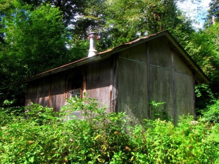
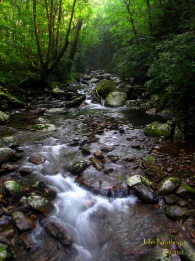
With one last hiker friendly horse trail left to do, it was time to finally knock out Tow String that connects the namesake horse camp with Bradley Fork Trail out of Smokemont. 
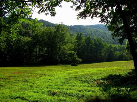
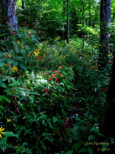
Looking across one of the open fields near the Tow String horse camp early on in the hike. For a horse trail, the conditions were superb minus one blowdown. Well graded, smooth stone surfaces at times, no mud pits, a job well done by the park service on this one!
0 Comments
It had been a few days since I had done any hiking. Of course, last Saturday I put on enough miles for the whole month, so some rest and recovery was well deserved. I was able to see my family and friends off on Sunday as they made their return back to Michigan. It was also great to see Bonnie for a brief moment later that afternoon before she made her way back up to the lodge. Interestingly enough, Sunday night saw the first snowfall in the park since early May. A few inches piled up at the upper elevations while those of us down below and in town received only rain. Imagine if that weather had happened but a day earlier. The last third of my hike navigating Mt. LeConte would've been hairy to say the least. After that, I had a few days to myself with nothing planned. On Monday I did nothing but sleep, eat, and waltz around town a little bit, but nothing I did that day required a lot of effort. but by Tuesday I was getting the itch to hike again, and I knew I needed to get going on pulling in some new miles for the year. I didn't want to go anywhere far or do something strenuous, so I found a suitable hike yet to be done in Smokemont. As always, the drive up and over Newfound Gap was pleasant, a bit cloudy this day and on the cool side. Thanks in part to the snowfall of a few nights past, the changing of the leaves had accelerated noticeably, especially in the vicinity of Newfound Gap. When I arrived at the Smokemont campground, trees were beginning to transform there as well. I parked at the Bradley Fork trailhead for the third time this year, but this time, the hike would be much shorter and easier on the legs. The air was cool and crisp, but it felt tantalizing. It was wonderful to finally be out in the park again, hitting the trails without a worry in the world. I was curious to see how my legs would react to moving again, since the last couple days around town my gate was more of a waddle than a walking stride. Luckily the ascent up Bradley Fork is slight as it follows the river. Occasionally, I'd come across a sudden but brief climb in which the back of my thighs would tighten. The more I pressed on, the looser my legs got, and I eventually forgot the matter all together. Many of the trails out of Smokemont are also used by horses, so they're wide but extremely muddy, especially after recent precipitation. There were a few places I had too dodge puddles or mounds of goop. Finally I reached the intersection with the Smokemont Loop Trail. This meant I was putting the horse trails behind me and raking in some new miles. Immediately one has to cross over the Bradley Fork on a lengthy single log footbridge. It has to be one of the longest of its kind in the park, for it's suspended the entire way across and extremely bouncy. A cable extending along one side serves as a meager handrail. Certainly one of the more interesting bridges I've crossed in the park, but I made it to the other side without a fuss. After that, the trail became narrower, less traveled, and steeper. The Smokemont Loop Trail reconnects the campground with Bradley Fork Trail by going up and over the crest of Richland Mountain's southern end. The ascent is gradual and satisfying. You never come to an overlook or a summit, but along the way it's possibly to see through the canopy and look down on the Oconaluftee River valley to the west. It was even better since the leaves were starting to change on the mountain opposite. My cadence was steady, but it sure seemed like an eternity before I finally reached the high point of the hike. I passed an older couple just before reaching the top, the only people I had seen on the trail all day, who had stopped for lunch and were thoroughly enjoying their afternoon as seen by the smiles on their faces. The descent wasn't all that exciting, and it passed quickly, perhaps because I was eager to be finished or that my mind was racing. Not quite sure, but I made it down with ease. The trail comes out near a cemetery and follows a service road for a few tenths before returning to the campground. I crosses an old stone bridge that is now gated off and also lacks a sign marking the trailhead. Since my vehicle was parked at the Bradley Fork trailhead, I had to walk some more around the campground to complete the loop. Along the way I saw the sign for the Smokemont Nature Trail and elected to do that as well. There were some neat footbridges to cross and then some rather steep climbs. Who knew that a nature trail would be more rigorous than it's longer, bigger brother? After that, I made it back to my automobile. It had started to warm up that afternoon, but not much, making it a very soothing atmosphere. Autumn had arrived in the Smokies for certain. I drove slowly out of the campground, with the windows rolled down. I was taking in the cool air, the sounds of leaves crunching under my tires, the smells of the campfires burning, and the sounds of families enjoying each other's company in the wilderness around the their tents and RV's. I enjoy being out in the woods and getting dirty, but I also enjoy the luxury of going back to a motel room with a comfy bed, warm shower, and a TV afterward. My simple reward after putting on so many miles. There were still some lingering clouds on the drive back, but when I reached the overlook at Luftee Gap, I pulled off real quick to snap a photo. One of the larger trees there was beginning to transform, appropriately signifying the changing of the seasons in the park. It's about to become a great time of year!
I could have easily thrown in the towel after yesterday's hike and taken the rest of my off days easy. But the distance I covered wasn't all the much, so frustration isn't the equivalent to exhaustion. Plus the weather was supposed to be great, so it would've been a waste not to get out in the park and tackle some miles. My hiking schedule had fallen by the wayside and my choices for hikes were becoming spur of the moment. It was easy in the spring and summer because I could work with the wildflowers, but when it gets into the summer, the only major factor is how to cope with the heat. Obviously I was NOT about to pick a hike that involved breaking trail and bushwacking. I also didn't want that long of a drive. So after some scanning over a map, my eyes keyed in on Smokemont. I saw a vast hole of unfinished trails to the east. The courageous juices started to flow and reconsidered a loop hike I had thought over many times. It was ambitious, but I was up for it. I was to do the Hughes Ridge Trail, and in order to complete as a day hike required many miles and a decent climb in elevation. The Peck's Corner shelter is one of the more isolated areas in the park, so I had some ground to cover. I had been to that very shelter once prior on my 2005 AT backpacking venture, so at least I didn't have to go all the way to the AT...not like that was far away. So back to the topic of beating the heat, and it being mid August, this hike would demand an early start. A number of things were working in my favor. Whichever way I decided to take up to Hughes Ridge, both trails were on the western side of the ridge. This meant my ascent which would surely bring about heavy persperation would at least be in the shade if I started early enough. I also had the luxury of that being the only climb of the day, for when I would reach Hughes Ridge, it would be relatively flat the rest of the way, and then I would have the descent to complete the loop. So once I hit the crest, I would at least be in somewhat cooler air and wouldn't be working nearly as hard. All I had to worry about now would be the trail conditions, in which the guide book describes my trails of ascent and descent as rocky and steep. Wonderful. Making my way up Bradley Fork and away from Smokemont, things were damp and the air moist. My camera lens was constantly fogging up so the picture taking wasn't really working out. My cadence was clicking and I reached the junction with Cabin Flats in no time. The intersection here is quite spacious and a few automoblies belonging to the park service were there. Though the trail follows an old roadbed, it is too narrow for such vehicles. And the bridge across the Bradley Fork the other direction is only for foot traffic. I wondered what trail they were working on and if I might meet them up ahead. I began the climb and could see the sun starting to come through the canopy to the west. I wondered how much time I had left before the sun would overtake the ridge and heat things up on my side. Not much changes in terms of scenery during this kind of ascent. It makes its way up through a ravine with a creek all the way to the top. The trail was rocky on average, but it wasn't the worst trail I'd ever been on. And sure there were a few stints that felt steep, but the climb wasn't that harsh, just persistent. The most interesting stuff going on during this part were the asters and goldenrods in bloom and the witch hobble trees sporting their bright red berries. I even passed a few rusty parts, one of which was hanging on a tree trunk. Before long I reached Hughes Ridge and had done so before the sun's rays could pummel me like a punching bag. The worst part was behind me, thankfully, so now it was north to Peck's Corner. Occasionally, parts of the trail were being encroached by thorny blackberries and ferns. Other than that, I was impressed by the rest of what Hughes Ridge had to offer. The path was smooth and the grade relatively flat as it followed the ridgeline. There weren't any views because of the dense growth of balsam firs, but they did a fine job of keeping the suns rays at bay. Add in the slight breeze rising up from the valley and across the ridgetop, the walk up to the shelter was absolutely pleasant. About a quarter mile from the shelter I came upon an opening in the woods down to my right. There sat an old and withering park service cabin that served as a horse patrol station and utility shack. The windows and doors were all caged up so there was no entry, but I could still see inside. It was neat to see some of the old tools and appliances left behind. I scoped out the area a little longer to see what else I might find, but the bugs around the building and thick brush were moving in, so I decided to move on out. As I mentioned, the backcountry shelter wasn't that far away. I was looking up at Peck's Corner directly ahead where the Hughes Ridge Trail eventually intersects the AT. I didn't have to go that far becaues the shelter itself is located about 0.4 mile down. As the trail entered the shelter's vicinity I could see down the hill and in the woods. I came to junction where the elaborate privy sat to my left, the AT was straight ahead, and the shelter was down to the right. This started to bring back memories from my 2005 overnight stay here with my father. If you take a look at my "Memorable Hikes" page, you'll see that I describe this area and the events that occurred upon our arrival. My entire time at the shelter while I ate my lunch was incredibly nostalgic. Not to mention I had just covered a great distance to reach this isolated part of the park, so I was pretty geeked in that regard. I had the entire place to myself, but there were these birds that would constantly go back and forth between the trees and the metal roof of the shelter. It was both entertaining and a racket, but I didn't mind. After soaking up my surroundings, I reluctantly packed up my stuff and headed out. It was great to make it back here after five years, and who knows when I'll be back. Of course I had to repeat the section of Hughes Ridge to the point where I came up Bradley Fork, but after that it was all new again. At least he miles anyways, the terrain was very similar with the smooth trail, rolling yet modest elevation change, and not really any views. The most exciting part came before the junction with Enloe Creek. I had just passed through a large gap in crest of Hughes Ridge and managed to spook a wild boar. It let out a loud grunt that lasted a few seconds and filled the air before finally sprinting away from me and downhill. I obviously couldn't snap a picture of it in time, but I did see its color. Most are that hideous black, but this one I wondered may have been a mix of wild boar and domesticated pig. It was a much lighter tan color, darker in the front but lighter toward the back. Looking around I could see signs of the destruction those beasts cause as they sift around for food. It is rather unfortunate. I gathered myself after a brief moment and continued heading south. The rest of the Hughes Ridge Trail from that point on saw more of the same. Although, there were a good number of summer wildflowers. Most included the asters, goldenrod, hawkweed, gerardia, and hare bells. I passed the Enloe Creek split and soon came upon my turnoff down Chasteen Creek. At one time the Hughes Ridge continued on toward Big Cove, but that trail has since been left to nature. The descent was somewhat rocky and steep. I was making great time because there wasn't much in the way of distractions. About halfway down it began to rain. For a while the forest canopy was doing a stellar job at blocking out the rain and keeping my dry. Even when it finally did break through, the cooling sensation was welcome relief. Now I hadn't packed my rain coat, so my pace had quickened in order to reach the Bradley Fork. Fortunately, the downpour was short lived and ceased aroung the time I reached Chasteen Creek Cascade. There are number of eroded paths that cut down toward the falls, but I remember reading about them in the guide book and I knew to look for a marked path up ahead. I took that to the base of the falls and took a few pictures and even a video. The picture makes it look flat and small, when in reality the falls is quite long and wide. Upon leaving the falls, a large group of people had arrived on horseback. It appeared to be a group of tourists not all that into hiking, evidenced by there overdressed attire. They were interesting to watch as they dismounted and then nervously stepped around mud, rocks, and roots while holding onto cameras, purses, and hats. It must've been a paid ride because two people, obviously not with the main group, stayed behind to tie up and tend to the horses. Now that the rest of my hike would be along a trail made especially for horses, I just knew the mud was coming, and that recent rain could have only made things worse. Sure enough, what I dreaded became reality. Seriously. Just look at that mess! All of the mud is deep and squishy and those murky brown puddles look more like the land of a thousand lakes. What gets me is how some of the trail descriptions in guide books tell hikers not to go off trail and through the woods, but to deal with the conditions and just go through the junk. Really? I mean, really? I am a bit disturbed that the park has done nothing to resolve this mess in a way that serves both hikers and horses. Couldn't they pour down gravel? What about building narrow boardwalks like on other horse trails? And this picture only shows but a small segment. It was like this all the way from the falls to the junction with Bradley Fork. Hiking was more like prancing through a mine field.
At least when I made the turn onto Bradley Fork to finish out the loop, the trail conditions improved somewhat. My boots weren't sinking into the mud and there were drier and rockier surfaces to work with. As daunting as that recent portion was, I wasn't about to let it dampen how I felt about the entire day. It really turned out to be a fantastic hike. I was grateful that it turned out to be not nearly as difficult as projected. I also came out of with a lot of new miles and a sense of accomplishment. Needless to say, my state of mind and body compared to 24 hours prior was far better. I was originally going to do the hike out of Smokemont up Bradley Fork the last time I was down, but since I didn't know if the work was completed at the campground, I chose to swap it with the Deep Creek hike and shorten the drive. Whether that was a good decision or not is yet to play out. Depends on if and when the park decides to clean up the Deep Creek Trail and what I end up seeing along today's hike. Regardless, any day in the park is a good day. The morning drive across Newfound Gap and into North Carolina saw views that were cloudy and quite hazy. The forecast called for a chance of showers and thunderstorms this week, but I couldn't let that hold me back. Oddly enough, when I passed by the upper trailhead for Deep Creek, the park trail maintenance crew had just arrived. Wow, how convenient. Only a week late, or I was just a week early. I would still be hiking ahead of them anyways in what would probably be even more overgrown trail conditions, so I say I hit it at the better time. Rolling into the Smokemont campground, one could tell normalcy had returned, for the entire place was full of campers, trailers, tents, and people all enjoying their summer in the mountains. I was just glad the thing was open again so that I could access the trailheads. The climb up Bradley Fork was enjoyable the whole way. Early on I was greeted by a clearing dotted with various wildflowers that included wild bergamot, the pink variation of bee balm, spiderwort, Queen Anne's lace, blackberries, asters, and evening primrose. The trail itself follows an old roadbed, so it's wide and well graded. It is also quite pleasant as it runs parallel to the waters of the Bradley Fork, sometimes at the same level, so you're afforded nice shots of the stream. Later on I passed some of the yellow fringed orchids like the ones I saw a week prior on Pole Road Creek. Toward the latter half of Bradley Fork Trail, you come to several stream crossings over wide bridges, obviously meant for horses or vehicles. The last bridge is the most interesting, it being an enclosed metal and wooden one with gravel at your feet. Quite fancy compared to most in the park. And the view overlooking the river on either side of the bridge was nice as well. At this point I have left the Bradley Fork Trail and turned uphill on the much narrower path of Cabin Flats. This section of trail is brief, leading to a vast streamside campsite in a mile and serving as a buffer between the Bradley Fork and Dry Sluice Gap Trails. Before reaching the campsite I stumbled some tall bellflower, a new one to add to the list. When I reached trail's end at the site, I didn't stay long since the annoying bugs that buzz around one's face were out in full force, so the only solution was to keep moving. When I returned to the junction with Dry Sluice Gap it was time to head uphill, but no longer the smooth ascent I had up til that point. Now I would climb 2,200 feet in 2.8 miles. Compare that to the popular Alum Cave Trail to Mt. LeConte which gains about 2,500 feet in 5.0 miles. So as you can see the hardest part of the day was still in front of me. The heat only added to the adversiy. The trail conditions weren't all the bad, only a few parts being overgrown or rocky. Near the end of the climb, the trail ventured through a wet and shaded ravine blanketed in coneflower, crimson red bee balm, love vine, and sweet joe pye-weed. I did all I could to not disturb the buzzing bees and fluttering butterflies as I pushed through the overgrown path. The higher I got in elevation I could see the ridges of the AT and upper Richland Mountain, but much of the sky was clouded over and gray. I was also getting the occasional breeze up from the valley which felt wonderful on such a hot day. I finally pulled into the junction with the Grassy Branch Trail which comes up from the western side of Richland Mountain, and a way I ventured up back in mid May in a loop hike past Charlies Bunion. Of course this time, I had no intention of going even further to reach the AT, so this intersection would be my turnaround. Thankfully it would be all downhill from this point on. I moved at a blistering pace, rarely stopping for pictures so that I could make it back to Gatlinburg to spend as much time as I could with friends and family that were visiting for the week. That also meant some quality time relaxing in the pool where we were all staying, and on such a hot afternoon after a good hike, one can't think of anything much better.
|
Thanks for visiting!I appreciate you stopping by. This site is for your enjoyment as much as it is mine. Look for new photos and journal entries about every 1-2 weeks. Archives
November 2011
Categories
All
|